





Outdated Maps, Real Consequences
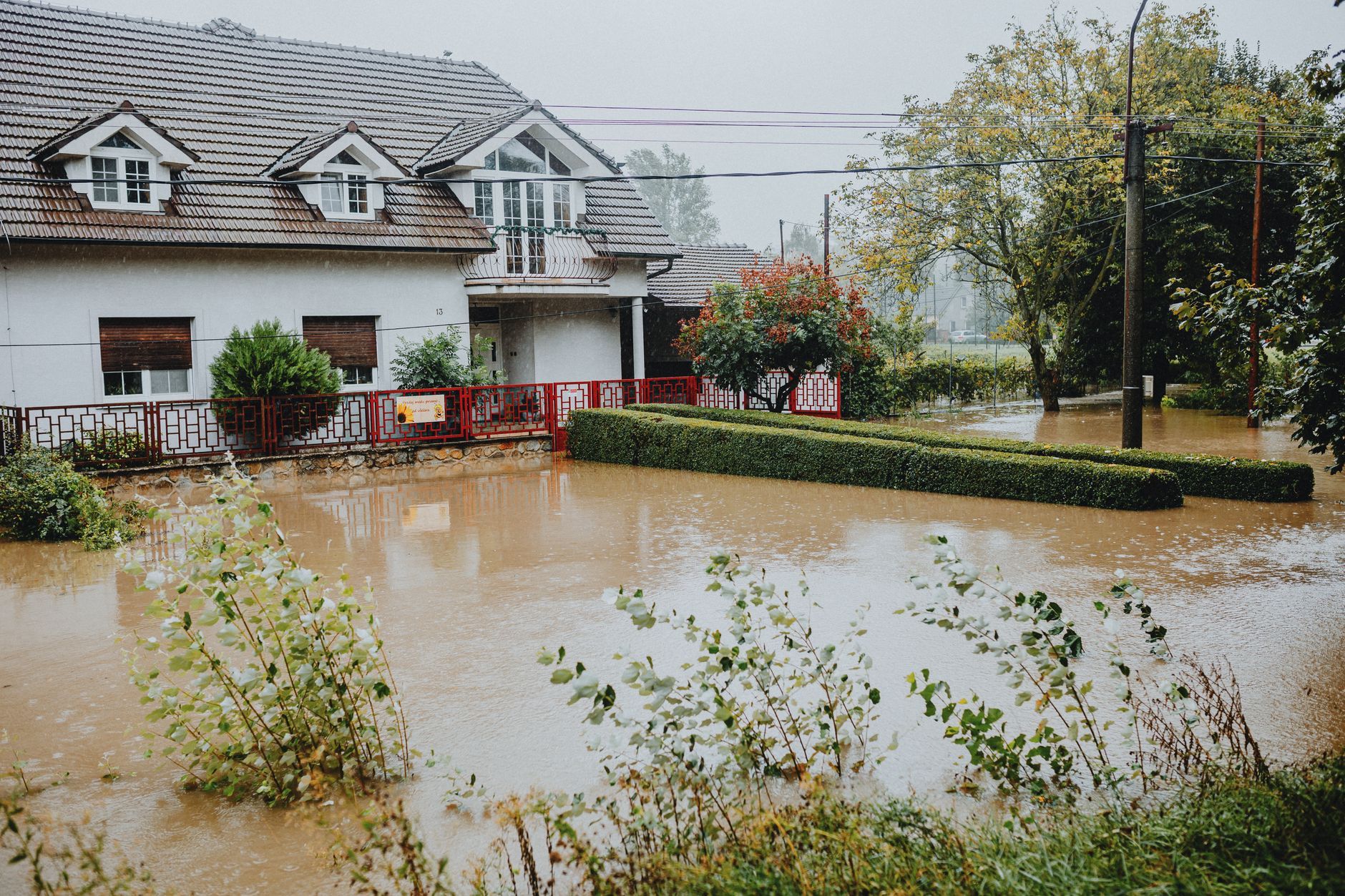
FEMA’s Flood Insurance Rate Maps are supposed to tell homeowners, lenders, and insurers where the water goes when things go wrong. Many of them haven’t been meaningfully updated in decades. Some counties are still operating on maps drawn before widespread satellite imaging, before major flood events reshaped local watersheds, and before climate patterns began delivering rainfall totals that older models never anticipated. The result is a growing gap between what the maps say and what the water actually does.
That gap has financial consequences measured in the billions. When flood risk is misclassified – either too high or too low – insurance premiums don’t reflect reality, property values are set on faulty assumptions, and mortgage requirements tied to flood zone designations send buyers into financial commitments based on stale data. The dysfunction isn’t limited to one region. It runs coast to coast, affecting rural river towns, Gulf Coast suburbs, and mid-Atlantic communities that have watched their flood profiles change while their official maps stayed frozen in time.
Why Updates Keep Stalling
FEMA’s Map Modernization program has been a recognized priority for years, but the agency faces a structural problem: remapping the country comprehensively requires sustained funding, local government cooperation, and technical resources that rarely arrive simultaneously. Congress has periodically allocated money for flood mapping improvements, but the pace of updates still trails the pace of physical change on the ground. A county that floods in 2018 might not see a revised official map until well into the 2020s – if it sees one at all.
The appeals process adds another layer of delay. When FEMA proposes a new flood map, affected property owners and local governments can formally dispute the findings. Appeals can stretch for years, leaving properties in regulatory limbo. During that period, lenders often default to the proposed map’s flood zone designation anyway, forcing homeowners to purchase flood insurance for a risk level that hasn’t been officially confirmed. They pay the premium; the map fight continues; the outcome remains uncertain.
Local governments have a complicated relationship with the remapping process. A town that gets remapped into a higher-risk zone faces immediate political pressure from property owners who suddenly face mandatory flood insurance requirements or see their home values drop. Some municipalities actively resist updates even when the underlying hydrology has clearly changed. Others lack the technical staff to engage meaningfully with FEMA’s modeling process, leaving them dependent on federal timelines they can’t control.

The Insurance Market Responds – Badly
Private insurers have been quietly pulling back from high-risk flood markets for years, partly because the maps they’re supposed to use for underwriting don’t match their own internal risk models. When a carrier’s proprietary data shows elevated flood exposure in a neighborhood that FEMA still classifies as low-risk, the insurer faces a choice: write policies at a price that reflects real risk and lose business to competitors using the cheaper federal classification, or match the market rate and absorb losses when floods arrive. Neither option is sustainable.
The National Flood Insurance Program was designed to fill the gap that private markets leave. It has run chronically in debt, partly because premiums were deliberately kept low for political reasons, and partly because the maps underwriting those premiums were themselves underestimating risk. Recent rate restructuring under FEMA’s Risk Rating 2.0 system attempted to connect premiums more directly to actual property-level risk rather than broad zone designations. That shift produced sticker shock for many policyholders whose bills increased sharply, and it exposed just how far the old pricing had drifted from reality. As federal crop insurance payouts grow with longer extreme weather seasons, the same underlying pressure – government-backed programs absorbing costs that markets won’t – is showing up across the flood insurance system too.
Homeowners Caught Between Systems
For a homeowner trying to buy or sell a property near water, the current situation offers no clean answers. A house sitting just outside a FEMA-designated Special Flood Hazard Area carries no mandatory insurance requirement for federally backed mortgages, but that designation may reflect a map that’s fifteen years old. Lenders who rely on the official classification aren’t doing anything wrong – they’re following the rules. The rules are just built on an incomplete foundation.
The burden of due diligence has effectively shifted onto individual buyers in ways most of them aren’t equipped to handle. A careful buyer can hire a private flood risk consultant, review historical loss data, and cross-reference FEMA maps against newer third-party flood modeling tools. Most buyers don’t do this, and even those who try run into a market where flood risk disclosure laws vary widely by state. Some states require sellers to disclose prior flood damage or insurance claims. Others don’t. A buyer in one state might get a full picture; a buyer two counties over, across a state line, might get almost nothing.
Sellers and real estate agents aren’t always forthcoming even where disclosure is technically required. The temptation to stay quiet about flood history is real when a disclosure could knock tens of thousands off a sale price or kill a deal entirely. Enforcement of disclosure requirements is inconsistent, and buyers who later discover undisclosed flood problems face expensive legal fights with uncertain outcomes. The map confusion gives everyone in the transaction plausible cover: if the official map says low risk, who’s to say the property is high risk?
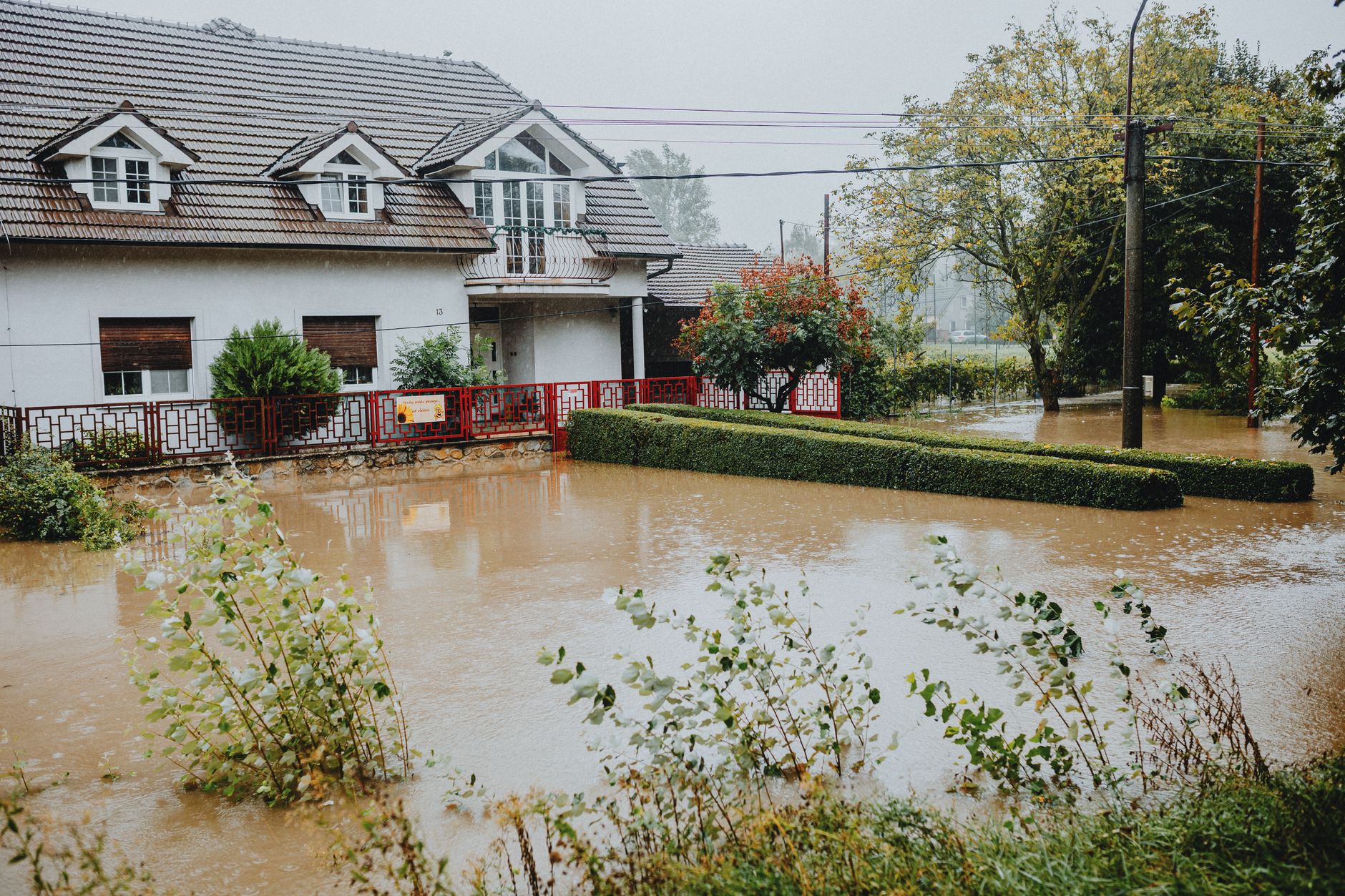
That question gets harder to answer after a major storm. Communities that flood repeatedly – places that have filed multiple NFIP claims on the same properties – often find that local map updates accelerate only after disaster strikes. The pattern is reactive rather than preventive: wait for damage, assess what happened, begin the remapping process, wait for appeals, publish a new map. The cycle can take a decade. In the meantime, properties that flooded twice are being sold to buyers whose lenders are still reading a map that predates both events. The price discovery that markets are supposed to perform – matching risk to value, risk to premium – keeps getting deferred, and the gap keeps widening.
Frequently Asked Questions
How often does FEMA update flood maps?
There is no fixed update schedule. Many maps are decades old, and updates depend on funding, local cooperation, and FEMA’s project pipeline, which frequently runs behind.
Do I have to buy flood insurance if my home is not on a FEMA flood map high-risk zone?
Federally backed mortgages don’t require it in low-risk zones, but outdated maps mean some low-risk designations no longer reflect actual flood exposure. Private coverage is still worth considering.